Walking a Metes-and-Bounds Traverse, with Closure Diagnostics
The Problem
A deed describes a parcel as a chain of calls: “thence N 45°00'00" E, 100.00 feet, thence S 45°00'00" E…” To know whether it closes — whether the last call lands back on the point of beginning — you convert each quadrant bearing to an azimuth, walk the coordinates, and see how far off you end up. It's rote, error-prone, and exactly what you want a page to do while you read calls off a scanned deed.
The Approach
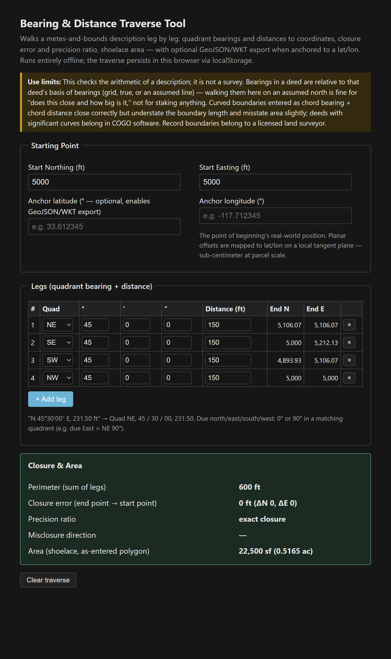
A leg table in deed form — quadrant (NE/SE/SW/NW), degrees/minutes/seconds, distance — with running coordinates computed per leg so you watch the traverse walk as you type. Each quadrant bearing becomes an azimuth (NE→θ, SE→180−θ, SW→180+θ, NW→360−θ), then ΔN = d·cos(az), ΔE = d·sin(az). Closure error is the straight-line miss from the final point back to start; precision is perimeter ÷ closure as 1:X; area is the shoelace formula on the closed polygon [1].
Closure as a debugging tool
The precision ratio isn't just a quality score — it's a diagnostic. Modern boundary surveys close 1:10,000 and better; older deeds check out around 1:5,000; and worse than about 1:3,000 almost always means a transcription error rather than sloppy original surveying — a transposed digit, a dropped leg, or a bearing read from the wrong quadrant. The tool encodes the folklore fix in its warnings: when a description won't close, flip the quadrant on the most suspicious leg first. NE mis-keyed as SE is the single most common deed-entry typo, and it produces a distinctive, large misclosure that the ratio catches immediately.
The work-hobby crossover: anchored export
Give it the point of beginning's lat/lon and the planar traverse maps to geographic coordinates via the local ellipsoidal radii — Δlat = ΔN/M(φ), Δlon = ΔE/(N(φ)·cosφ), GRS80, US survey foot — and exports GeoJSON or WKT. At parcel scale that's accurate to well under a centimeter, and the polygon drops straight into QGIS, JOSM, or the GeoJSON/WKT inspector. The anchor's own accuracy governs, though: a phone-GPS point of beginning puts the whole parcel within phone-GPS accuracy of reality.
How I verified the traverse math
- A rotated square (N45E / S45E / S45W / N45W, 100 ft each) closes to exactly zero with exactly 10,000 sf.
- An axis-aligned rectangle via due bearings closes exactly at 20,000 sf.
- A deliberately flipped quadrant produces 141 ft of misclosure at 1:3 precision — and the warning fires as designed.
- The lat/lon export round-trips 1,000 ft north and east to a millionth of a foot.
Single file, vanilla JS, localStorage persistence. The deed or record map (and its basis-of-bearings note) governs [2].
The tool: Bearing & Distance Traverse Tool.
References
- [1] Ghilani & Wolf, Elementary Surveying — traverse computation, closure, and precision standards.
- [2] The deed or record map being walked — the governing description and its basis of bearings.